Map Viewer Plus

Map Viewer has been further enhanced

Map viewer plus on computer screen


Landgate has aerial imagery covering a large portion of Western Australia. Aerial imagery has been captured from 1948 to the present day and is available to view at no cost. Aerial imagery may be purchased online with Map Viewer Plus.

Subject to the conditions prescribed by the Copyright Act 1968 (Cth), you may not copy or reproduce Map Viewer Plus aerial imagery in any form, including screenshots, unless you have purchased it.

Please note: Landgate can only provide support for imagery purchases when evidence of purchase can be provided.

Launch Map Viewer Plus

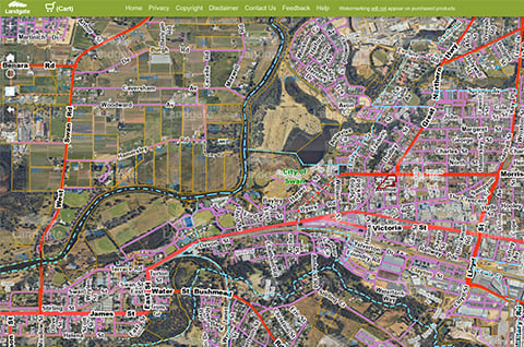
What is Map Viewer Plus?

Map Viewer Plus is an online viewing tool used to pan across and zoom in over current and historical aerial imagery along with layers of geographic information. Map Viewer Plus now services the surveying industry by the inclusion of authoritative geodetic and survey information. With better search options, as well as predictive search, you will find what you're looking for in less time.

Map Viewer Plus is compatible with current versions of a wide range of browsers including Chrome, Firefox, Safari and Edge plus with mobile functionality, you will be able to access Map Viewer Plus on your tablet or smartphone while on the go.

With Map Viewer Plus you can:

  • pan and zoom to view current and historical aerial imagery
  • view layers of authoritative geographic and administrative data.
  • search by numerous criteria
  • search and purchase title documents and property reports
  • purchase aerial imagery for almost anywhere in the state
  • measure distances and calculate determine land areas and determine spatial position
  • access geodetic and survey information from around the State.

Map Viewer Plus is useful for:

  • viewing land and property in Western Australia
  • discovering geodetic and survey marks
  • showing property boundaries
  • researching a property purchase or sale
  • providing a base for urban and regional planning
  • assisting with asset management
  • agricultural and natural resource management.

What you need to place an order:

  • a property street address or select an area of interest
  • debit or credit card
  • email address

Map Viewer Plus Support

  • If you're experiencing issues with Map Viewer Plus please ensure your browser is updated to the latest version.
  • Read more about how to use Map Viewer Plus.

View and buy aerial imagery today

The quickest and easiest way is to use Map Viewer Plus.

Launch Map Viewer Plus

FormatPrice
JPEG$25.50 plus $0.54 per MB
ECW/GeoTIFF/JPEG 2000$85.00 plus $0.54 per MB

Prices apply to online ordering via Landgate website only, up to a maximum of 25GB. All file sizes refer to uncompressed image size for price calculation purposes. The delivered product is a compressed image.

Find answers to your most common enquiries about Map Viewer Plus.

What is aerial imagery?

Aerial imagery is 'photographs' taken from an aircraft at a predetermined altitude and commonly along a predetermined flight grid. All aerial imagery available online is taken vertically, that is, perpendicular to the earth's surface.

What is an aerial image mosaic?

Landgate joins hundreds of individual aerial 'photographs' to form one seamless image called a mosaic. It allows you to pan, zoom and select imagery over an area of your choice.

Are your Aerial Images orthorectified?

Yes, all our mosaics are digitally corrected to allow for distortions caused by the curvature of the earth’s surface, relief and any lens aberrations.

Are your Aerial Images georeferenced?

Yes, all our imagery is georeferenced. This means our imagery can be related to a ground system of coordinates. However, purchasing imagery in JPEG format will not include this information.

Is your Aerial Imagery Live?

No, the aerial imagery you see online is a mosaic of ortho-rectified photographic images captured at a point in time. We capture imagery of the Perth metropolitan area in summer and winter every year, regional centres annually, the outer metropolitan area every two years and other areas every five to ten years. Imagery is available from 1948, but the majority of our online archive starts from 1999. We are continually updating our online aerial image library.

Can I purchase Aerial Imagery taken prior to 1999?

Yes, our aerial imagery dates from 1948 onwards. You can purchase a print, enlargement or a digital scan of any of our historical photography.

What do I get when I buy aerial imagery online?

You will receive:

  1. Aerial imagery for the area you have selected.
  2. A licence which advises you on the permitted usage of the imagery after purchase.
  3. Supporting information (metadata). For example, the date of capture and ground resolution.
  4. For ECW, J-PEG 2000 & GeoTIFF only, geo-referencing (coordinate and zone) information to advise of the image's spatial position.

How can I pay online?

You can pay for your imagery online in two ways:

  1. Credit card (MasterCard and Visa are accepted)
  2. Landgate Customer Account. To enable payment via your Landgate Customer Account you must access the services via MyLandgate. To do this, log in to MyLandgate and select aerial photography under Online Shop from your MyLandgate channel homepage. This will take you to the aerial photography service and will pre-populate your account details within the shopping cart.

For further details about opening a Landgate Customer Account please call + 61 (0)8 9273 7373 or email customerservice@landgate.wa.gov.au

Will the imagery I buy online show property boundaries?

No, your imagery will not show the property boundary lines that you can see on the Map Viewer Plus.

How do I choose the best format?

As a general rule if you are buying small images for general purpose use it is best to select a JPEG format. Images in this format can be used within standard graphical/desktop publishing and word processing software, and for that reason, they are not geo-referenced.

If you are buying larger images for professional use it is best to select ECW or JPEG2000 format. Please refer to the detailed information below on the various formats we offer.

JPEG (or JPG) is the best format for general use of smaller sized aerial images, but contains no spatial attribution or location information. Note: Please be aware that large-size JPEG images (e.g. over 100MB) may be difficult to load into your software package. If you require a large size image, it is suggested that you consider ordering an ECW or JPEG2000 format image.

ECW format is best for imagery of particularly large areas. ECWs are geo-referenced and maintain the quality of an image as you zoom in. It does this by automatically reconstructing the image as you zoom in, maintaining the best possible resolution for that scale.

JPEG2000 is a similar format to ECW, and suited for imagery over particularly large areas. JPEG2000 (or *.JP2) will provide much better image quality at smaller file sizes than the standard JPEG format. This format is also geo-referenced and best to use when high visual quality at a reduced file size is required.

GeoTIFF (as the name suggests) has geo-referencing information embedded with a TIFF file. It is an uncompressed format and is best for general use of smaller sized aerial images. Note: Please be aware that large size GeoTIFF images (e.g. over 500MB) may be difficult to load into your software package. If you require a large size image, it is suggested that you consider ordering an ECW or JPEG2000 format image.

What image resolution do I choose?

Image resolution is linked to ‘ground measurement‘. Landgate recommends that images are ordered at their default ground measurement (resolution) where possible.

If you wish to change the resolution of an image you will need to alter the ground measurement (in pixels) of the image. You can do this by going to the 'Image Output Properties'. Then select the appropriate 'Ground Measurement' value. Please refer to samples of imagery to view various resolutions so as to determine which is best for your purpose.

Note: The ground measurement shown on the screen (defaulted) will be as it was when the imagery was initially captured. Changing the ground measurement value of an image will affect the price and quality of your aerial imagery product.

If you require your image to be changed to another ground measurement that is different to that made available online, please call +61 (0)8 9273 7373 or email geodata@landgate.wa.gov.au for further details. Please note that charges will apply.

Can I order the image in another projection?

Yes. To do this, go to the "Image Output Properties" screen and then select "Advanced Output Properties". Then continue by choosing the appropriate "Projection" and "Datum" for your image.

Note: The projection/Datum shown (defaulted) will be that of the aerial image at the time of capture. Changing the projection of your image will not affect the price of your aerial imagery order.

Can I remove the white or black spaces around the image?

A ‘black space’ on a portion of the imagery is an area that was historically restricted for public viewing for security reasons, e.g. Prisons and Australian Defence Force installations. They cannot be removed. Recent imagery are no longer affected by ‘black space’.

A ‘white/black space‘ that exists on the edge of an aerial image displays the boundary of the mosaic. To view imagery outside of these boundary lines, you need to refer to the adjacent mosaic.

When will my imagery be delivered to me?

The online shop will deliver your imagery via email or download within approximately 30 minutes.

What internet browser software do I need?

This service has been developed to work with the major internet browsers with the exception of Internet Explorer.

Are there any terms and conditions about how I use the imagery I buy?

Yes, the aerial imagery you purchase must be used in a manner specified by a Landgate licence which you will be asked to accept at the time of purchase.

This page was last updated on: 09 May 2023