Skip to main content Skip to navigation

APX-03 Field record examples

Version 1 - 13/03/2018

This guide is intended as general information only. If you are uncertain of your rights or interests, please seek professional legal advice. Landgate staff are not able to give legal advice or to draft your documents. Please read our Terms of Use above.

Example Description
1 Field record index page: normal subdivision, repeg, survey strata etc, including geodetic connection under Regulation 22A.
2 Field record index page: SSA re-establishment and control survey.
3 Field record index page: SSA re-establishment and control survey, deposited plan number known.
4 Field record index page: GNSS survey.
5 SSA re-establishment and control survey.
6 SSA subdivision: connection to state geodetic survey network.
7 SSA subdivision; graphical summary of re-establishment and control connections.
8 SSA subdivision; graphical index to control network.
9 SSA subdivision: graphical summary of initial control network.
10 Normal subdivision: connection to SSM (Reg 22A).
11 Cadastral control survey for spatial upgrade – single point radiation by GNSS.
12 GNSS survey: cadastral pickup and geodetic connection.
13 GNSS survey: graphical summary of GNSS baselines of control network.
14 GNSS survey: tabular results of GNSS baselines.
15 GNSS survey: tabular results of network adjustment.
16 GNSS survey: measuring parcel boundaries.
17 GNSS survey: tabular results of RTK observations (eastings and northings).
18 GNSS survey: tabular results of control and boundary observations.
19 GNSS Survey: Tabular Results of VRS Observations.

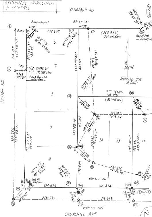
1. Normal Subdivision, Repeg, Survey Strata Including Geodetic Connection under Regulation 22A

Capture

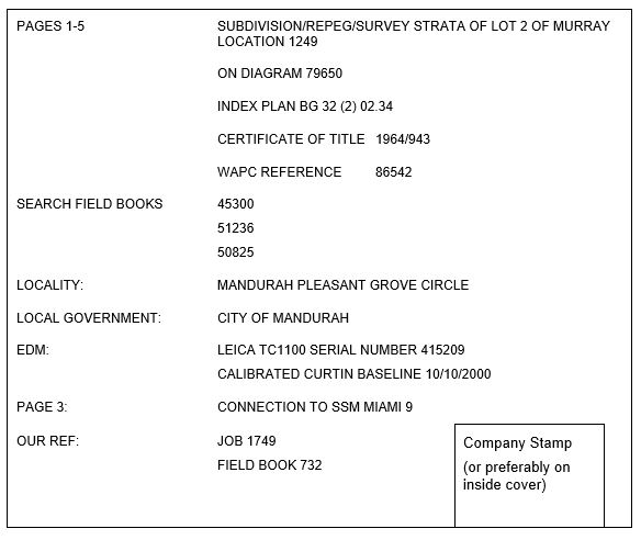
2. SSA Re-establishment and Control Survey

Example-2

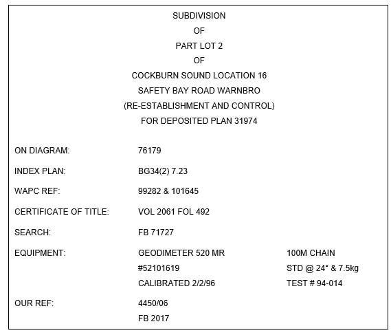
3. SSA Re-establishment and Control Survey, Deposited Plan Number Known

Capture-2

4. GNSS Survey

Capture-3

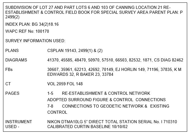
5. Special Survey Area re-establishment and control survey

APPENDIX3_Page_06_Image_0002

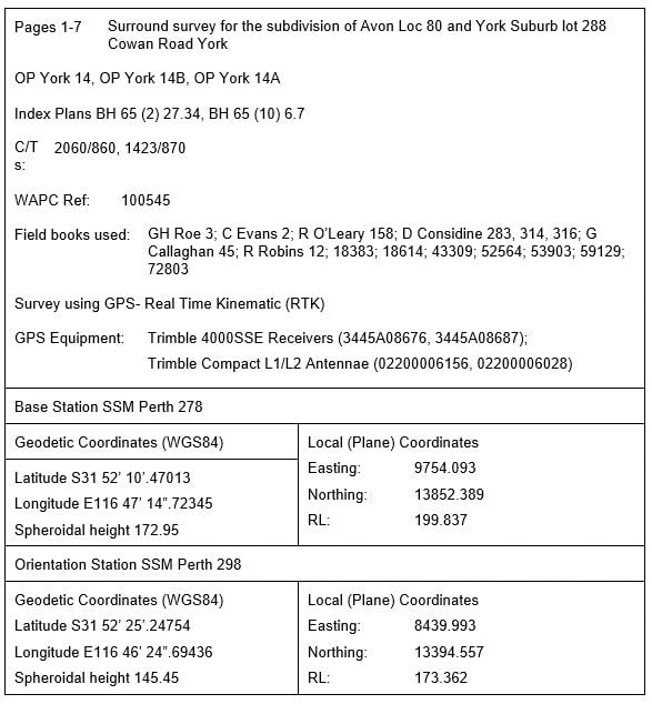
6. Connection to State Geodetic Survey Network

APPENDIX3_Page_07_Image_0002

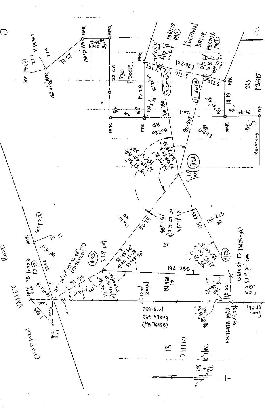
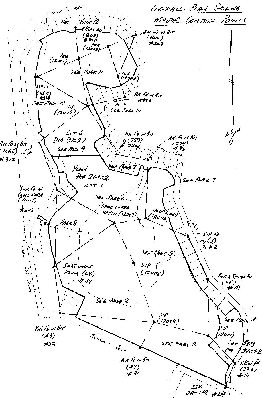
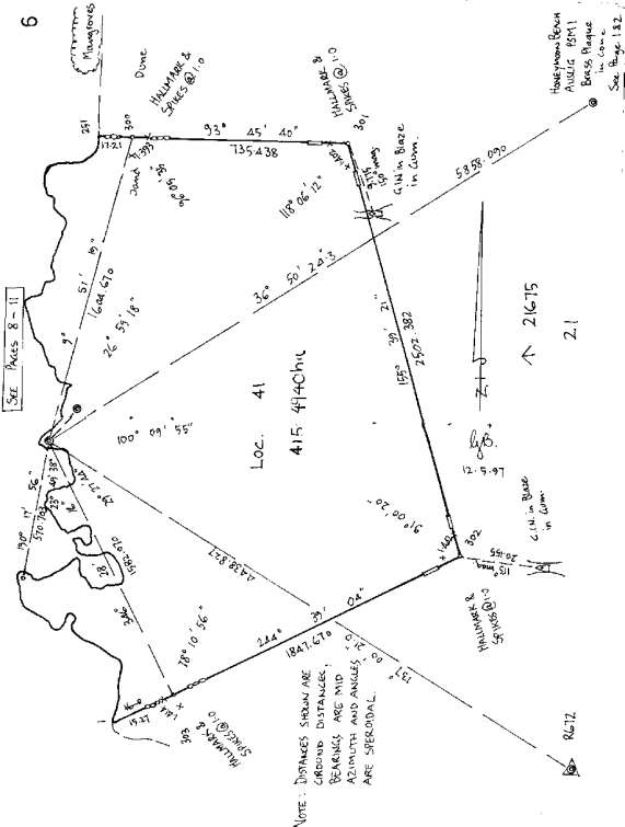
7. SSA Subdivision: graphical summary of re-establishment and control connections

APPENDIX3_Page_08_Image_0002

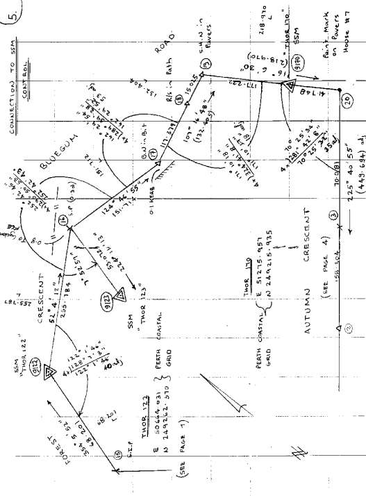
8. SSA subdivision: graphical index to control network

APPENDIX3_Page_09_Image_0002

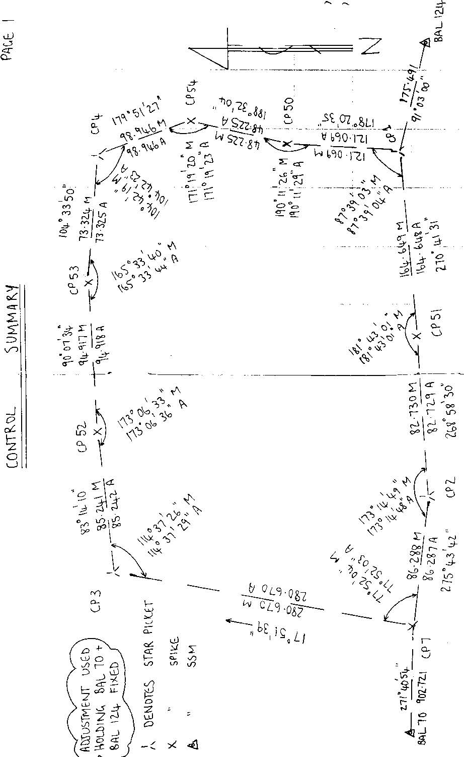
9. SSA subdivision: graphical summary of initial control network

APPENDIX3_Page_10_Image_0002

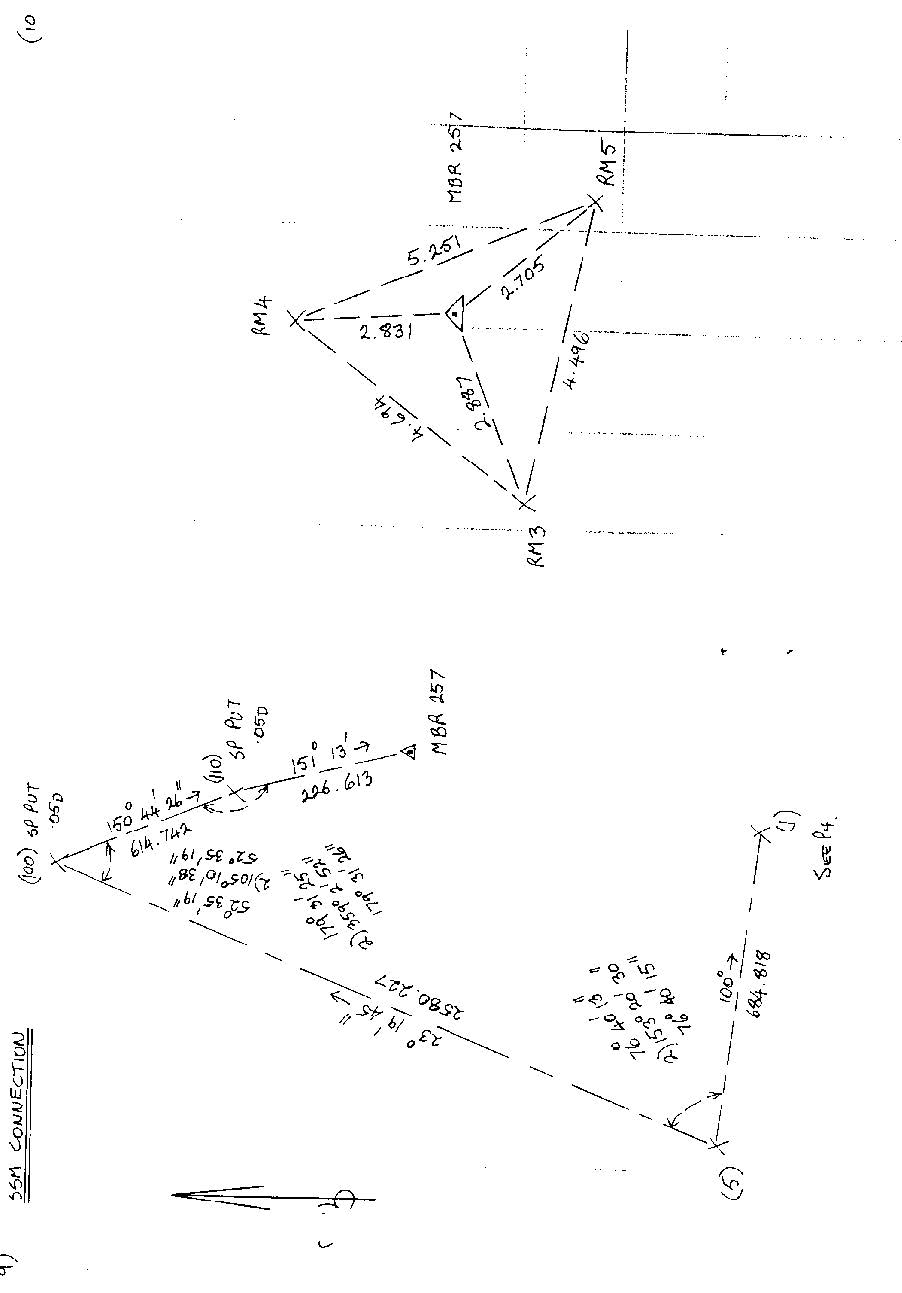
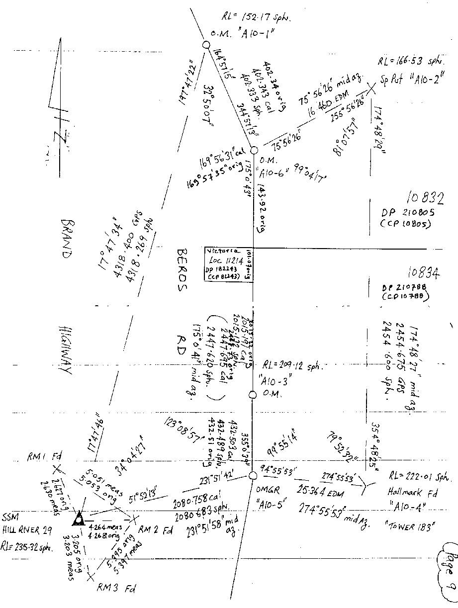
10. Normal subdivision: connection to SSM (Reg 22A)

APPENDIX3_Page_11_Image_0002

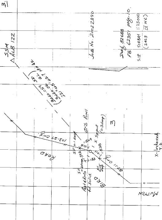
11. Cadastral control survey for spatial upgrade - single point radiation by GNSS

APPENDIX3_Page_12_Image_0002

12. GNSS survey: cadastral pickup and geodetic connection

APPENDIX3_Page_13_Image_0002

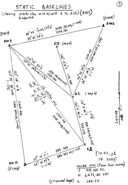
13. GPS survey: graphical summary of GNSS baselines of control network

APPENDIX3_Page_14_Image_0002

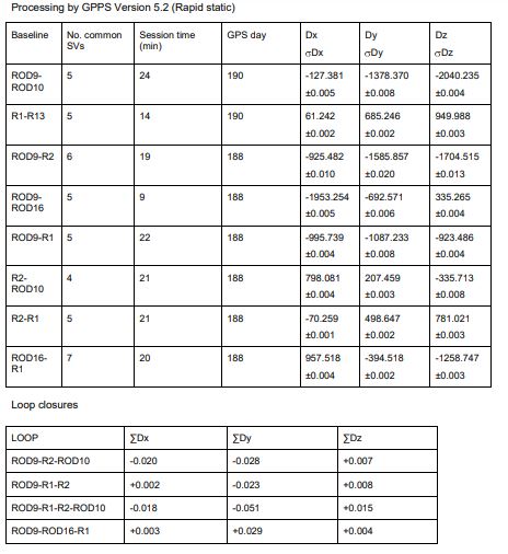
14. GPS survey: tabular results of GNSS baselines

Image-14

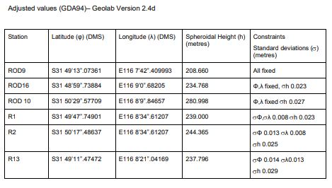
15. GNSS survey: tabular of network adjustment

Image-15

16. GNSS survey: measuring parcel boundaries

APPENDIX3_Page_17_Image_0002

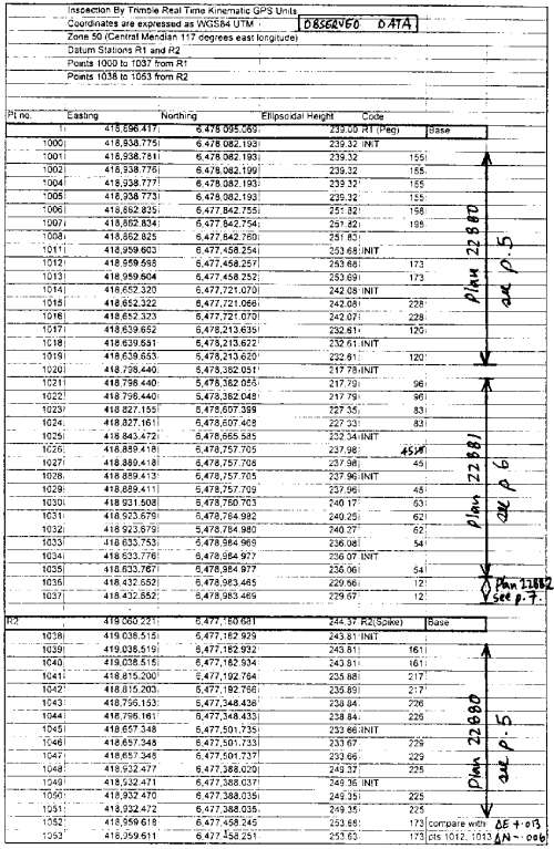
17. GNSS survey: tabular results of RTK observations (eastings and northings)

APPENDIX3_Page_18_Image_0002

18. GNSS survey: tabular results of control and boundary observations

APPENDIX3_Page_19_Image_0002

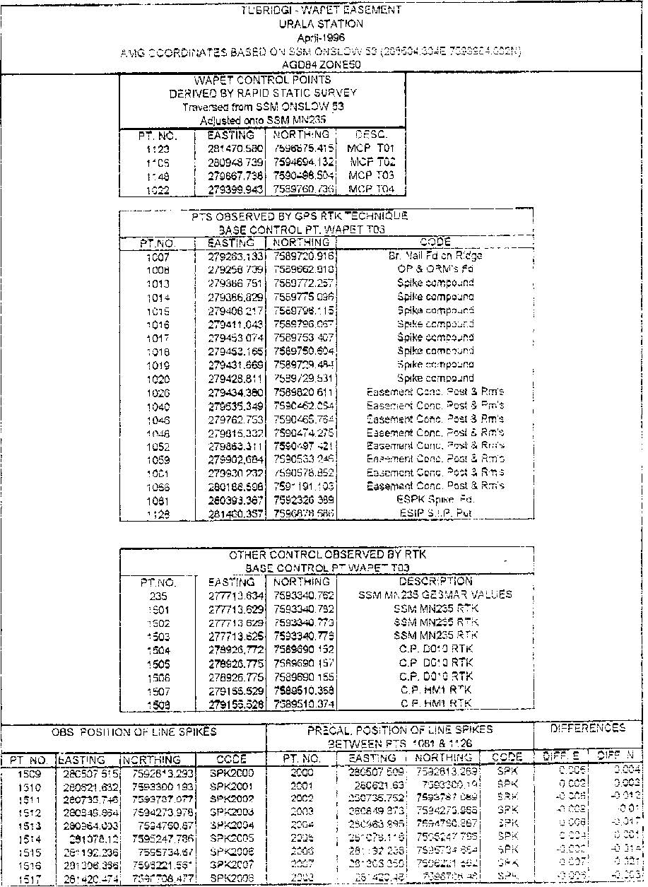
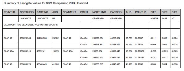
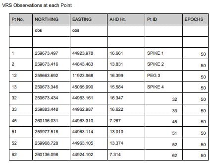
19. GNSS survey: tabular results of VRS observations

Image-19

Image-20